
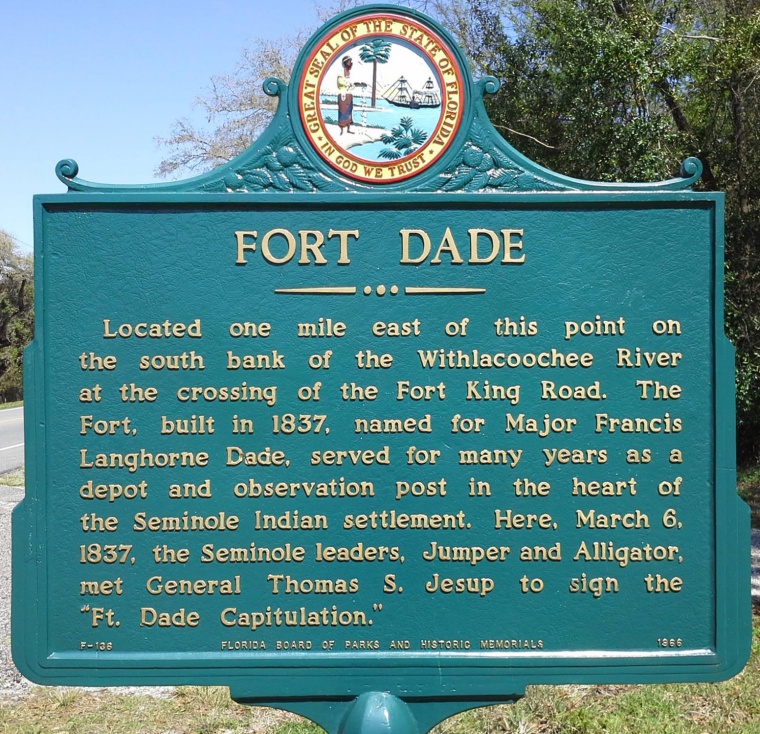
| FORT DADE HISTORICAL MARKER. This marker is located on US Highway 301 approximately 0.1 mile south of the Withlacoochee River bridge, on the east side of the highway within view of the bridge. The bridge is approximately 1 mile north of the CR-575 intersection with U. S. 301 or approximately 3 miles south of State Road 50 intersection with U. S. 301. Although the historical marker describes the location of Ft. Dade as “one mile east of this point,” there is no direct route from the marker to the location of the fort. CR-575 crosses the Withlacoochee River approximately 2.1 miles south of SR-50, and the generally accepted location of Ft. Dade is just south of the river. CR-575 follows the approximate route of the original Ft. King Road, defined on the older maps as the “road from Tampa (Ft. Brooke) to Ft. King (Ocala).” Photo by Scott Black. |